Thunderstorms likely by mid afternoon with yellow weather warning in place in Doncaster

and live on Freeview channel 276
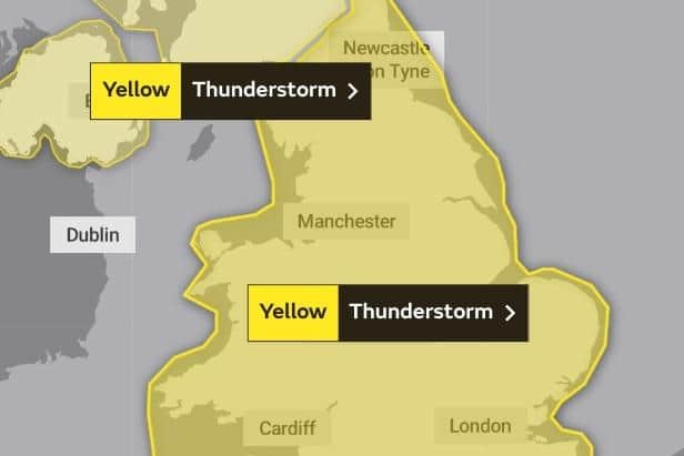
A yellow weather warning is in place for much of England today (August 15) due to moderate chances of thunderstorms and a small risk of flash floods.
According to the Met Office, there will be hit-and-miss thunderstorms likely to develop through Monday, producing some torrential downpours for some spots, and possible disruption.
Advertisement
Hide AdAdvertisement
Hide Ad

Rain will be patchy but heavy between 2pm and 5pm, before drying up for the rest of the evening with hazy, clouded over skies and a breeze of up to 15mph.
The rain will also mark a noticeable cooling in temperatures, as the ongoing heatwave of 25C+ will drop down to a more manageable 22C, around 19C on Tuesday.
The weather warning is in place for flash floods as dry ground after hot weather has difficulty absorbing water, which could lead to run offs during the heavy showers.
In these confusing and worrying times, local journalism is more vital than ever. Thanks to everyone who helps us ask the questions that matter by taking out a subscription or buying a paper. We stand together. Dominic Brown, editor.
Comment Guidelines
National World encourages reader discussion on our stories. User feedback, insights and back-and-forth exchanges add a rich layer of context to reporting. Please review our Community Guidelines before commenting.