Walking on both sides of the River Don
This article contains affiliate links. We may earn a small commission on items purchased through this article, but that does not affect our editorial judgement.


The route although relatively simple did require a couple of nifty about turns to stay on the PRoW. Adds to the excitement and mystery of a Ramblers tour.
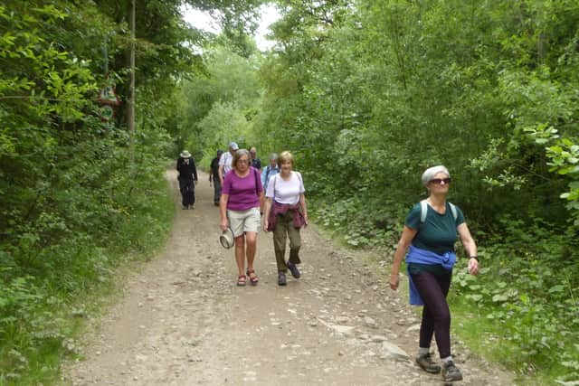
Anyway ten of us set off from Dale Road heading north east up Windgate Hill hugging the tree line on a wide path to pass first under Conisbrough Viaduct then the railway line to reach
Advertisement
Hide AdAdvertisement
Hide AdSprotbrough Bridge about two and quarter miles later, but not before negotiating two iron “kissing gates” and a heavily rutted tracks.
After luncheon on the banks of the Don the return route took us not on the familiar Trans Pennine Trail, but the elevated footpath through Sprotborough Flash where we got the
occasional flash of sunlight off the mighty Don.
Descending onto the TPT the tarmacked surface providing the ideal substrate for cyclists, who we managed to dodge right and left as we shared the trail.
The climb by the side of the viaduct left everyone a little breathless and not just because of the view.
Advertisement
Hide AdAdvertisement
Hide AdWe crossed the Don by the Earth Centre and exited via the railway station before a final dramatic view of Conisbrough Castle guided us back to the start.
It’s a privilege to lead these Doncaster Ramblers walks and not more so than when a new comer remarks “That was great,
loved the walk, loved the company, book me on the next two”! Six and a half miles in total .
Places of interest: The River Don
The River Don is a river in South Yorkshire and the East Riding of Yorkshire, England. It rises in the Pennines, west of Dunford Bridge, and flows for 70 miles (110 km) eastwards, through the Don Valley, via Penistone, Sheffield, Rotherham, Mexborough, Conisbrough, Doncaster and Stainforth. It originally joined the Trent but was re-engineered by Cornelius Vermuyden as the Dutch River in the 1620s, and now joins the River Ouse at Goole.
Advertisement
Hide AdAdvertisement
Hide AdRules continue to change regarding outdoor exercise and group activity so please visit our website Doncaster Ramblers for latest, including future activity.
Also follow us on Facebook Doncaster Ramblers Facebook page for details of past Rambler outings.
Remember while out observe social distancing, carry a mask, hand sanitiser, and gloves. Obey the Countryside Code and give way to other walkers.
Doncaster Ramblers have had a programme of Tuesday and Saturday walks, mostly between eight and eleven miles in length, for about 30 years. The location of these walks varies from walks local in the Doncaster area like Tickhill, Sykehouse or Askern, to walks in the Derbyshire Peak District, Nottinghamshire, Lincolnshire and West Yorkshire.