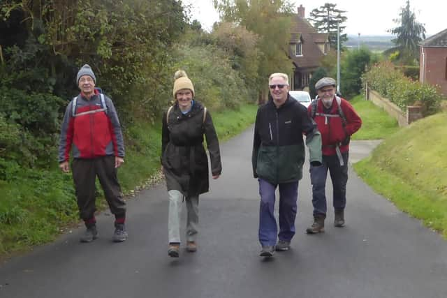
Plenty of planning before Doncaster Ramblers stride out


Luckily, computer wizardry make the task a lot easier – and more fun – as you drag routes across the page, adding and taking away miles.
Yet even this is not the finish, no, the route is checked for hazards, detours, stop off, and points of interest.
Advertisement
Hide AdAdvertisement
Hide AdSo it was on this wander among the fields just north of Westwoodside on the very fringe of the Isle of Axholme.
A look at the map shows this area festooned with footpaths, north, south, east, west, making planning a five-mile circular both hard and easy.
Five of us set off north on Mill Hill, and after just 300 metres found the footpath blocked by nettles and brambles, but luckily found an easy detour around the hazard.
Back on track, we continued north on the Peatland Way, then east through Haxey Turbary Nature Reserve.
Advertisement
Hide AdAdvertisement
Hide AdLate autumn was beginning to strip the leaves from the trees bringing a haunting atmosphere to the woodland.
The route now took us south through acres of turf as far as the eye could see.
Occasionally the opportunity arises for a bit of foraging, mostly windfall fruit, or blackberries, so a recently harvested field of beetroot was a chance not to be missed, to dig up a few kilograms from the path edge.
“I’ll pickle these, or maybe make some wine,” said one rambler, bent over he continued to pick.
Working our way through the northern edge of the village, passing The Carpenters Arms pub, the last mile took us on a southern loop through farmland before a steep climb back onto Tower Hill and the welcome sight of our cars.
Another ‘nice little walk’, in Adwick and Bentley Community Woodland, turned out to be seven-odd miles in an unconventional figure of eight.
We set out from Adwick Station across the footbridge left along the road then immediately left down steps into dense shrub for 500m, before crossing the busy railway, then turning right to continue in the general direction south.
Advertisement
Hide AdAdvertisement
Hide AdNavigation was spot on, as there were no obvious signs of a footpath or way markers.
The route continued for one-and-a-quarter miles, in parts made passable with care due to the needless dumping of dredging waste onto the footpath.
At the junction with the Trans Pennine Trail we turned left for 600m, passing under the A19 and entering the Bentley Community Wood.
Created on the site of Bentley Colliery in 2004, it offers a mixture of woodland colour throughout the year, plus more than three miles of footpaths.
Advertisement
Hide AdAdvertisement
Hide AdWe followed an anti-clockwise circuit, stopping at March Lane lake for a coffee break.
Retracing our steps almost exactly now south along the TPT then sharp right north, but this
time after quarter of a mile, we took a fork right heading through a magnificent archway of overhanging branches stretching for almost a mile into the distance.
Turning left on Adwick Lane it was just a short hop back to the station.
For more information about the group, see doncasterramblers.org.uk or fb.com/doncasterramblers