DONCASTER RAMBLERS: Sprotborough circular alternative route
and live on Freeview channel 276
This walk takes in the long anti-clockwise sweep of the River Don and the raised dyke but misses out the climb up to Cusworth Hall (included on most other anti-clockwise walks from Sprotborough)
The walk begins at the junction of New Lane and Cadeby Road at the footpath sign pointing south.
Advertisement
Hide AdAdvertisement
Hide AdFollow the metalised road to the end then continue right /left on a dirt path with hedge on left.
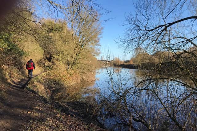

Shortly you descend steps, to reach a road, follow this downhill exiting onto Nursery Lane, cross to reach the banks of the River Don.
Turn left and follow the path for almost two miles. On route spot the remains of an old pumping house from C1700, before passing under the A1(M) then the Trans-Pennine Train a finally under railway before climbing onto the embankment.
At the two mile mark as the river bends right take care to follow the footpath right passed a stile. After 300 yards swing sharp left and follow a broad path to steps across the railway turn right and after 100 yards look for steps leading down.
At the bottom turn right.
Advertisement
Hide AdAdvertisement
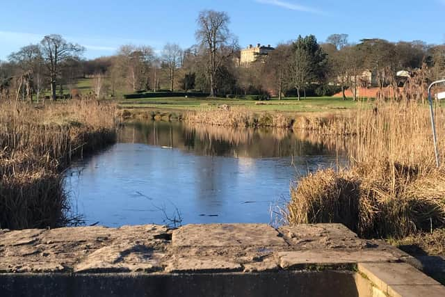
Hide AdContinue on the trans-Pennine trail for 0.8 miles to reach sign pointing left to Cusworth Hall.
Follow the lower of the two paths for ¼ mile to reach an information panel.
Turn left and continue for another 0.8 miles initially with lakes to your right but then on a wide path by open fields.
As this swings away right continue straight on a less defined path towards the motorway embankment.
Advertisement
Hide AdAdvertisement
Hide AdAfter passing a small group of trees the underpass diagonally to your right
Continue through the underpass and head towards the pylon and a large barn beyond that.
Just before the barn take the footpath left which exits onto Melton Road.
Turn right then left after 140 yards.
There is a gate on the right after 85 yards to the cricket field enter and head towards the far-left corner to cross a step stile, turn left onto Thorpe Lane then right onto main street and back to the start.
The distance is 5.8 miles and took two and a half hours.
Advertisement
Hide AdAdvertisement
Hide AdDoncaster Ramblers have had a programme of Tuesday and Saturday walks, mostly between eight and eleven miles in length, for about 30 years. The location of these walks varies from walks in the Doncaster area like Tickhill, Sykehouse or Askern, to walks in the Derbyshire Peak District, Nottinghamshire, Lincolnshire and West Yorkshire.
For more information visit https://www.doncasterramblers.org.uk/ or follow Doncaster Ramblers on Facebook https://www.facebook.com/doncasterramblers/
*Take care when walking and follow the Countryside Code. Follow government advice, walk alone or with one member of your household. Obey social distancing rules and give way to other walkers. Only walk locally.
In these confusing and worrying times, local journalism is more vital than ever. Thanks to everyone who helps us ask the questions that matter by taking out a subscription or buying a paper. We stand together. Nancy Fielder, editor.
Comment Guidelines
National World encourages reader discussion on our stories. User feedback, insights and back-and-forth exchanges add a rich layer of context to reporting. Please review our Community Guidelines before commenting.